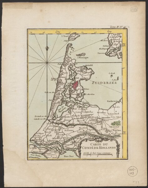
Utrecht University Library, Special Collections
ArcGIS, QGIS or web apps can simply use this map with web map services. WMTS, TileJSON or XYZ tiles are provided for quick access to processed maps.
Sign in to get links.
Sign in to download GeoTIFF.
Overlay & compare
iiif viewer, iiif info json
Website
Catalog
Carte du Comté de Hollande
1874-20497
Maps of the Netherlands and Dutch regions
1764
[Jacques Nicolas Bellin]
[Paris] : [Jacques Nicolas Bellin]
18 × 23 cm
1 : 700000
300